FRIDAY
2.15PM UPDATE
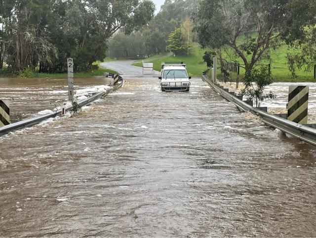
Macedon Ranges had approximately 250 requests for assistance including five in water rescues of people who entered flood waters against strong advice.
Gisborne SES unit controller Michael Bagnall said all requests for assistance were completed by 2am this morning and SES crew are remaining on standby if required.
“Residents could monitor weather forecasts and remain on alert as the water subsides,” Mr Bagnall said.
“In total, 45 volunteers from Gisborne SES worked through yesterday through the night to clear all requests for assistance.”
10.15AM UPDATE
Ninety-eight Powercor customers in Woodend South are still without power, as the electricity provider continues restoration efforts.
Powercor said the outages were due to damages caused by falling trees.
“A generator will be connected to supply power to customers in Woodend by early afternoon as repairs are expected to take a number of days,” Powercor said.
14/10 10AM UPDATE
VicEmergency has downgraded the flood warning for Deep Creek and Jacksons Creek from major to moderate.
The update replaced the Watch and Act messages issued at 4.35am and 3.15am.
Residents are still being urged to avoid the flooded areas.
“The level of the Deep Creek at Darraweit Guim has peaked at 7.68 metres overnight. The water level is currently at 6.13 metres, exceeding the Moderate Flood Level (6.10 metres) and falling,” VicEmergency said.
For Jacksons Creek, VicEmergency said the level of the Rosslynne Reservoir is currently at 51.7 metres and steady, around the Moderate Flood Level.
“It is expected to peak around the Moderate Flood Level (51.70 metres) Friday morning (14 October 2022),” VicEmergency said.
Macedon Ranges council is continually updating its list of road closures.
High Street in Lancefield, Murphy Street in Romsey and Romsey Road, at Old Lancefield Road in Woodend have reopened, as of 12.09am.
There are still many roads closed across the region, check the updates here:
https://www.mrsc.vic.gov.au/About-Council/News/News/Severe-weather-event-heavy-rainfall-and-flood-preparation
7.50AM UPDATE
A watch and act warning has been issued for Deep Creek, urging residents to head to higher ground.
A VicEmergency alert issued at 3.15am today (October 14) said water levels of the Jacksons Creek, Deep Creek and the Maribyrnong River at various locations are rising in response to the rain.
“The level of the Deep Creek at Darraweit Guim is currently at 6.67 metres, exceeding the Major Flood Level (6.50 metres) and falling. It is expected to drop below the Major Flood Level Friday morning,” VicEmergency said.
THURSDAY
4.30PM UPDATE
Residents in Woodend and Gisborne remain without power, while Macedon Ranges residents continue sharing footage of wild weather and flooding.
In a statement from Powercor this afternoon, the electricity provider said there are about 2700 customers in Woodend and Gisborne without power.
“We expect further power outages to occur over the coming afternoon and evening, as wild weather pushes through Victoria,” Powercor said.
“We have been monitoring the weather over recent days and have our crews, control room and customer centre ready to respond if power outages do occur.
“Our focus is on the safety of our communities we operate and our people.
“While crews will be responding to faults as quickly as possible, road and ground conditions will limit access to some areas and may mean it takes longer to reach fault locations and restore power. We ask customers to remain patient as our crews work in these difficult conditions.”
Gisborne SES unit controller Michael Bagnall told Star Weekly crews had responded to about 60 to 70 jobs in Gisborne and Woodend.
“[It’s been] mostly localised flooding of residential properties and significant number of road closures in localised areas,” he said.
“We’ve had four priority one rescue events of people who have driven into flood waters.
“We’ve got about 30 crew currently activated. We’re going to have crews working through the night.
“Over the past two days we’ve had a sandbag collection point opened at both Gisborne and Woodend SES units. We’ve distributed approximately 5000 sandbags to residents who are self preparing.”
He said it was vital people did not enter flood water.
Residents have taken to social media to complain about a lack of mobile coverage, which they describe as dangerous.
Woodend resident Andrew Price said he hadn’t been able to make phone calls all day, and without a landline, he was cut off.
“[Bad mobile coverage is] an inconvenience all the time, and in a disaster situation it’s obviously dangerous,” he said.
“You don’t have access to the information you need, you don’t know where road closures are, you don’t get flood warnings.
“My daughter who lives in Geelong was panicking because four of us couldn’t receive phone calls.”
3.30PM UPDATE
More roads are closed across the Macedon Ranges ranges as flooding continues.
According to Macedon Ranges council, closed roads as of 3.21pm include:
– Settlement Road, Clarkfield – CLOSED
– Bolinda-Darraweit Road, Darraweit Guim – CLOSED
– Baringo Road, Baringo – CLOSED
– Govans Lane, New Gisborne – CLOSED
– Walkers Road, Woodend – CLOSED
– Bawden Road, Woodend – CLOSED
– Quarry Road, Woodend – CLOSED
– Russells Road, Woodend North – CLOSED
– Glenfern Road, Romsey – CLOSED
– Burke and Wills Track, Baynton (Annek Lane) – CLOSED
– Falloons Road, Ashbourne (South of Ashbourne Road) – CLOSED
– Mount Macedon Road, Macedon (Turritable Road) – CLOSED
– Baynton Road, Lancefield – CLOSED
– Croziers Road, Newham – CLOSED
– Joyces Road, Monegeetta – CLOSED
– Three Chain Road, Carlsruhe – CLOSED
– Boundary Road, Woodend – CLOSED
– Waterloo Flat Road, Bullengarook &ndash ;CLOSED
– Ashbourne Road, Ashbourne – CLOSED
– Lawson Road, Macedon – CLOSED
– Clancys Lane, Woodend North – CLOSED
Unable to Access Roads to Close – these roads are impassable as per advice from local CFA:
Mahoneys Road, Woodend
Slatey Creek Road, Woodend
Council updated its list of closures due to the severe weather:
– Hanging Rock Reserve and Hanging Rock Cafe (13 and 14 October)
– All Council managed kindergartens (13 and 14 October)
– All Maternal and Child Health Centres – clients with appointments will be contacted today with option for telehealth appointment or reschedule. (13 and 14 October)
– Woodend Service Centre
– Woodend, Kyneton and Romsey libraries.
– All Macedon Ranges Shire Council Aquatic and Fitness facilities are closed from 2pm today and are expected to remain closed until at least 12pm tomorrow. Learn to Swim families and Aquatic and Fitness members will receive further information via SMS.
Some properties are still facing power outages across the region.
Romsey resident Michelle Downes described attempting to brave the roads earlier today in order to feed her horse in Kilmore as “scary”.
She did not make it there due to the flooding.
“The roads are all blocked there…Even driving on the main road from Romsey towards Lancefield. All around me the paddocks were under water,” she said.
“It’s been relentless. Just at the end of my street the horses are knee deep in water.”
While Ms Downes property is on higher ground, she said with the rain expected to continue into the night, she was worried for her neighbours.
“I’ve heard someone’s sheep is swimming in the paddock trying to get on higher ground,” she said.
“We knew it was going to be bad… the reality hits when you see the devastation all around you.”
1.40PM UPDATE
Multiple towns in the Macedon Ranges are dealing with power outages as flooding continues.
Powercor’s outage list estimates power to be restored by 2.30pm.
Woodend resident Kylie Swain has headed to Sunbury to escape the weather, as she’s still recovering from the trauma of last year’s June storm.
“I couldn’t do it again… the ground last year is not nearly as wet as it is now,” Ms Swain said.
“Even if we just get a small amount of wind, it’ll easily topple trees over.
“I went to go leave… I got turned around on one route and took another, I do believe it’s going to be very hard to leave very shortly.”
In a Facebook post at 11.30am today, Gisborne SES said they were closing the sandbag collection point.
“The sand on the front lawn is being used for requests for assistance we are responding to in the community,” the post said.
Macedon Ranges council has updated its listed of closed roads:
– Mount Macedon Road, Macedon (Turritable Road) – CLOSED
– Baynton Road, Lancefield – CLOSED
– Croziers Road, Newham – CLOSED
– Joyces Road, Monegeetta – CLOSED
– Three Chain Road, Carlsruhe – CLOSED
– Boundary Road, Woodend – CLOSED
– Waterloo Flat Road, Bullengarook &ndash ;CLOSED
– Ashbourne Road, Ashbourne – CLOSED
– Lawson Road, Macedon – CLOSED
– Clancys Lane, Woodend North – CLOSED
For up to date information on road closures, see the VicRoads alerts page http://alerts.vicroads.vic.gov.au/
Residents are reminded to never drive through flood waters.
Residents who require emergency assistance in storms or floods can contact SES on 132 500. If an emergency is life threatening contact Triple-0.
12.45PM UPDATE
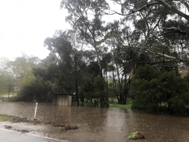
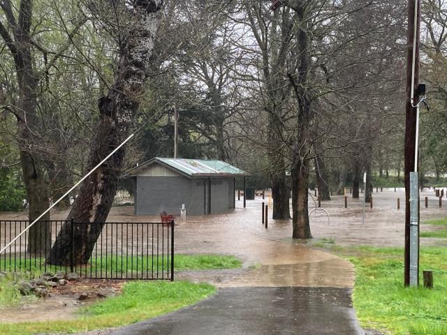
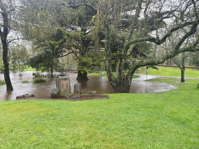
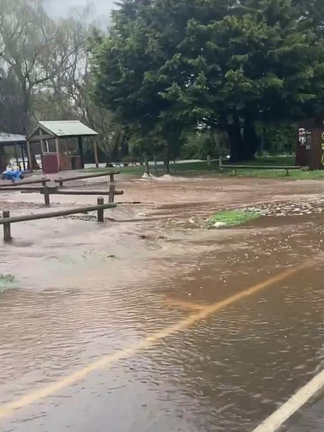
Macedon Ranges social media pages are awash with footage of flooding across the region.
Some residents are offering their spare rooms and bungalows as they watch the waters rise.
On Facebook, one resident posted that water was now covering Ashbourne Road between Slatey Creek Road and Booths Lane in Woodend.
Woodend resident Daron Jacks said he hadn’t seen the town look the way it does in 11 years.
“Five Mile Creek is rising down the road, it’s broken the banks and it’s just getting higher and higher,” Mr Jacks said.
“I wouldn’t be surprised if the children’s park, next to the Lawn Bowls, goes under.”
Martin Beaumont from Woodend said as of noon today the power at his property just off Ashbourne Road in Woodend had cut out.
“We’re without power, we purchased a residential battery… it has provided us with power when it goes out, which it’s doing right now,” he said.
“My battery tells me I’ve got 24 hours of power left at the current rate of consumption.
“I’ve just spoken to our neighbour who doesn’t have a battery so he’s cranked out his pizza oven.”
North-east from Woodend in Lancefield, Mustys Bridge over Deep Creek is reportedly closed, residents have posted.
At about 11am, a resident posted footage of water rushing over Forbes Road at Springfield.
A major flood warning was issued for Deep Creek at 9.59am today.
EARLIER
As residents battle rising flood waters, heavy rain and damaging winds in the Macedon Ranges, council kinders, libraries and some tourist spots have been closed.
Woodend is experiencing
Mt Macedon resident Deb Davis said she’d been helping her neighbour sandbag her property as it was flooding.
When she’d driven to Gisborne SES to collect sandbags, they’d run out of sand.
“Council came and dug a trench, but now water is coming in so bad that it’s engulfed the bottom section of their house and they’ve had to rip up all the carpets in bedrooms,” Ms Davis said.
“I drove for [my neighbours] back to Gisborne, but upon arrival there was not enough for everyone.”
As of 9.45am, closed roads in the Macedon Ranges include:
– Mount Macedon Road, Macedon (Turritable Road) – CLOSED
– Baynton Road, Lancefield – CLOSED
– Croziers Road, Newham – CLOSED
– Joyces Road, Monegeetta – CLOSED
– Three Chain Road, Carlsruhe – CLOSED
Gisborne SES has put out a reminder to residents that it only takes 15 centimetres of water to float a vehicle.
“That’s the height of an average pen,” a Gisborne SES Facebook post said.
“Never drive through floodwater – it could save your life.”
Residents who require emergency assistance in storms or floods can contact SES on 132 500. If an emergency is life threatening contact Triple-0.
Council is urging residents with property or content insurance to contact their insurance companies as soon as possible after the event.
More to come.

