
By Oliver Lees
Is it a bird? Is it a plane? No, it’s a helicopter fitted with state-of-the-art scanning technology.
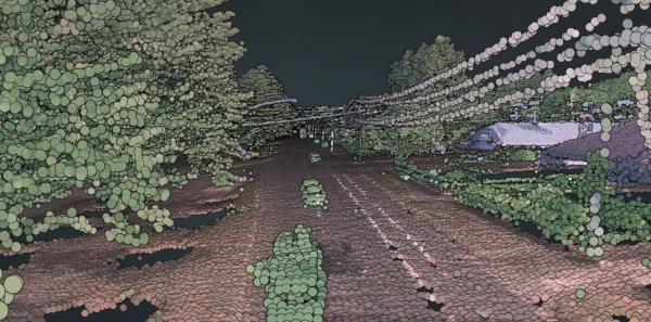
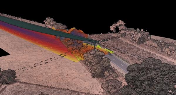
Over the next two weeks, two Powercor helicopters will be flying over parts of the Macedon Ranges, using Light Detection and Ranging (LiDAR) technology to map out the proximity of vegetation to powerlines.
The data, which aims capture imaging across 2400 kilometres, will be used to assist in Powercor’s annual tree-cutting and maintenance schedule.
The fleet includes two Bell 505 helicopters, each with two pilots aboard, and capable of hitting a top speed of 232km/h.
The aircrafts will be flying across Gisborne, Woodend and some surrounding suburbs at just over 300 metres.
Powercor head of vegetation management, Hugh Vickers-Willis said by facilitating their own aerial inspections, Powercor is able to improve safety, data quality and efficiency.
“By making these improvements to our aerial services, we are further reducing the risk of fire and improving the reliability of the network,” Mr Vickers-Willis said.
“This data helps ensure we identify which trees to cut, by how much and when.
“This is all about community safety and it’s something we’re continuing to invest in as we work to keep the network safe and reliable.”
Powercor distributes its resource across 88,000 kilometres of wires, which powers 25 per cent of Victoria’s gross domestic product.
For more information call Powercor on: 9683 4342.


